« Do Markets Cure Consumer Mistakes? Schwartz paper | Main | Unifying Ideas in Game Theory: Symmetric-Player Games vs. Principal-Agent Games »
November 05, 2004
County Level Election Maps 2000 and 2004, Vanderbei Purple America Maps

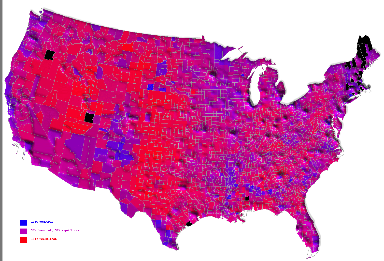

Robert J. Vanderbei of Princeton has
posted county-level election maps, blending red
(Republican) and blue (Democrat). Of course the colors
should be the opposite, especially for 2000, when Yale Blue
Bush ran against Harvard Crimson Gore. The first maps are
for 2004. The second one has bumps for where the population
is greatest. The third one has just Red and Blue depending
on who got a majority in the
county.
The second set of maps are for 2000-- one of
Prof. Vanderbei's "Purple America" maps, and one that uses
just Red and Blue depending on who got a majority in the
county.


Posted by erasmuse at November 5, 2004 05:23 PM
Trackback Pings
TrackBack URL for this entry:
http://www.rasmusen.org/mt-new/mt-tb.cgi/291